ESA WorldCover
The ESA WorldCover product provides global land cover maps for 2020 and 2021. By combining the strengths of both Sentinel-1 (SAR) and Sentinel-2 (optical), it achieves a more consistent global result than optical-only products. The 2020 version (v100) and 2021 version (v200) use slightly different algorithms, so users should exercise caution when performing direct change detection between the two years.
Data Availability & Collections
The WorldCover map is accessible via the Planet Insights Platform as a Bring Your Own COG (BYOC) collection.
-
Collection ID:
0b940c63-45dd-4e6b-8019-c3660b81b884 -
Update Frequency: Annual (2020 and 2021 currently available).
Basic Facts
| Property | Value |
|---|---|
| Sensor | Sentinel-1 (C-SAR) and Sentinel-2 (MSI) |
| Spatial Resolution | 10 m |
| Geographic Coverage | Global |
| Coordinate System | WGS 84 (EPSG:4326) |
| Data Format | Cloud Optimized GeoTIFF (COG) |
| Temporal Coverage | 2020, 2021 |
| License | CC-BY 4.0 |
| Provider | Planet |
Band Information
The collection contains the main classification map and a multi-band quality layer.
| Name | Description |
|---|---|
| Map | Main discrete classification according to FAO LCCS scheme (11 classes). |
| InputQuality | 3-band layer indicating the number and quality of S1 and S2 inputs used per pixel. |
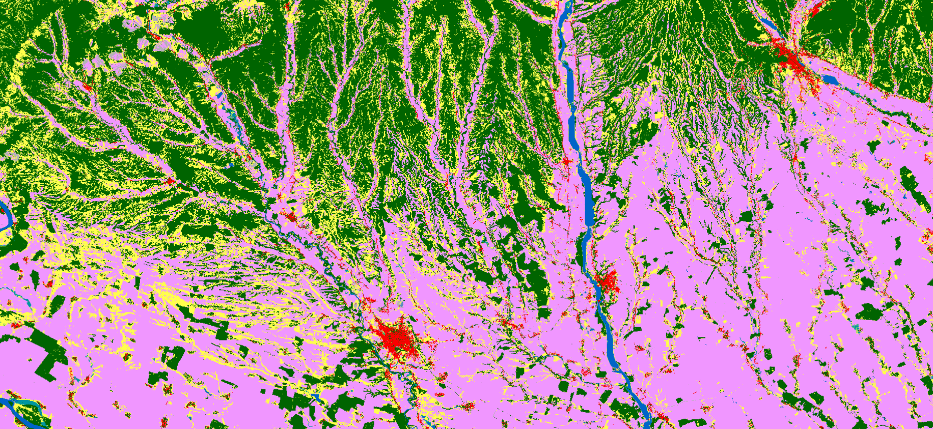
Class Definitions
The Map band contains the following 11 land cover classes:
| Value | Label | Color |
|---|---|---|
| 10 | Tree cover | #006400 |
| 20 | Shrubland | #ffbb22 |
| 30 | Grassland | #ffff4c |
| 40 | Cropland | #f096ff |
| 50 | Built-up | #fa0000 |
| 60 | Bare / sparse vegetation | #b4b4b4 |
| 70 | Snow and ice | #f0f0f0 |
| 80 | Permanent water bodies | #0064c8 |
| 90 | Herbaceous wetland | #0096a0 |
| 95 | Mangroves | #00cf75 |
| 100 | Moss and lichen | #fae6a0 |
Accessing the Data
Planet Insights Platform API
To access the data programmatically:
-
Endpoint:
services.sentinel-hub.com -
Collection Type:
byoc-0b940c63-45dd-4e6b-8019-c3660b81b884
Visualization Script (Evalscript)
Use the following script to visualize the WorldCover map with its standard color palette:
// VERSION=3
// ESA WorldCover Visualization Script
const colormap = [
  [10, 0x006400], // Tree cover
  [20, 0xffbb22], // Shrubland
  [30, 0xffff4c], // Grassland
  [40, 0xf096ff], // Cropland
  [50, 0xfa0000], // Built-up
  [60, 0xb4b4b4], // Bare / sparse vegetation
  [70, 0xf0f0f0], // Snow and ice
  [80, 0x0064c8], // Permanent water bodies
  [90, 0x0096a0], // Herbaceous wetland
  [95, 0x00cf75], // Mangroves
  [100, 0xfae6a0], // Moss and lichen
];

const visualizer = new ColorMapVisualizer(colormap);

function setup() {
  return {
    input: ['Map', 'dataMask'],
    output: { bands: 3 },
  };
}

function evaluatePixel(samples) {
  return visualizer.process(samples.Map);
}
Attribution
© ESA WorldCover project / Contains modified Copernicus Sentinel data (2020/2021) processed by ESA WorldCover consortium.