Copy for LLM[View as Markdown](https://docs.planet.com/platform/integrations/ogc/additional-request-parameters/)
# Additional Request Parameters
WMS/WMTS/WFS/WCS services support many custom parameters which affect the generation of the service responses. In the following table, all of the available custom parameters are listed. All these parameters are optional.
For the examples on how to use them, see this [example](https://docs.planet.com/platform/integrations/ogc/examples.md).
note
Atmospheric correction is no longer a parameter as L2A atmospheric correction is the only supported parameter. Refer to [information about atmospheric correction](#atmospheric-correction) for more information.
| Custom parameter | Info | Default value | Valid value range | Available for |
| ---------------- | ------------------------------------------------------------------------------------------------------------------------------------------------------------------------------------------------------------------------------------------------------------------------------------------------------------------------ | ------------- | ---------------------------------------------------------------------------------------------------------------------------------------------------------------------------------------------------------------------------------------------------------------------- | ---------------------------------------------------------------------------------------------------------------------- |
| TRANSPARENT | Adds alpha channel to the output where supported by the format, for example, PNG. | FALSE | TRUE/FALSE | **WMS/WMTS/WFS/WCS** (when REQUEST = `GetMap`, `GetTile`, `GetCoverage`, `GetFeature`, `GetFeatureInfo` or `GetIndex`) |
| MAXCC | The maximum allowable cloud coverage is in percent. Cloud coverage is a product average and not viewport accurate hence images may have more cloud cover than specified here. | 100.0 | 0.0 - 100.0 | **WMS/WMTS/WFS/WCS** (when REQUEST = `GetMap`, `GetTile`, `GetCoverage`, `GetFeature`, `GetFeatureInfo` or `GetIndex`) |
| PRIORITY | The priority by which to select and sort the overlapping valid tiles from which the output result is made. For example, using `mostRecent` will place newer tiles over older ones; therefore, showing the latest image possible. Using leastCC will place the least cloudy tiles available on top. | `mostRecent` | `mostRecent`, `leastRecent`, `leastCC`, `leastTimeDifference`, `maximumViewingElevation` | **WMS/WMTS/WFS/WCS** (when REQUEST = `GetMap`, `GetTile`, `GetCoverage`, `GetFeature`, `GetFeatureInfo` or `GetIndex`) |
| EVALSCRIPT | This parameter allows for a custom evaluation script or formula specifying how the output image will be generated from the input bands. See the Custom evaluation script usage for details.
EVALSCRIPT parameter has to be BASE64 encoded before it is passed to the service. | | | **WMS/WMTS/WCS** (when REQUEST = `GetMap`, `GetTile` or `GetCoverage`) |
| EVALSCRIPTURL | This parameter allows for a custom evaluation script or formula to be passed as a URL parameter, where the script itself is located (it should be on HTTPS). The URL is fetched with a 1 second connection timeout and a 2 second total response timeout. If it is not retrieved within these limits, the request fails. | | | **WMS/WMTS/WCS** (when REQUEST = `GetMap`, `GetTile` or `GetCoverage`) |
| GEOMETRY | Outputs imagery only within the given geometry and cropped to the geometry's minimum bounding box. | | one WKT string, one WKB hex string, or a list of coordinate pairs representing a polygon (pairs separated by semicolons, components by comma, for example, 1 1, 2 2;...) Coordinates should be specified using the CRS of the request (for example, same CRS as BBOX). | **WMS/WMTS/WCS** (when REQUEST = `GetMap`, `GetTile` or `GetCoverage`) |
| QUALITY | Used only when requesting JPEGs. | 90 | 0 - 100; where 0 is the lowest and 100 the highest quality | **WMS/WMTS/WCS** (when REQUEST = `GetMap`, `GetTile` or `GetCoverage`) |
| UPSAMPLING | Sets the image upsampling method. Used when the requested resolution is higher than the source resolution. | NEAREST | NEAREST, BILINEAR, BICUBIC | **WMS/WMTS/WCS** (when REQUEST = `GetMap`, `GetTile` or `GetCoverage`) |
| DOWNSAMPLING | Sets the image downsampling method. Used when the requested resolution is lower than the source resolution. | NEAREST | NEAREST, BILINEAR, BICUBIC, BOX | **WMS/WMTS/WCS** (when REQUEST = `GetMap`, `GetTile` or `GetCoverage`) |
| WARNINGS | Enables or disables the display of in-image warnings, like "No data available for the specified area". | YES | YES, NO | **WMS/WMTS/WCS** (when REQUEST = `GetMap`, `GetTile` or `GetCoverage`) |
## Atmospheric Correction
Satellite images sometimes seem washed out or foggy, as atmosphere absorbs and scatters light on its way to the ground. We can correct for this to get clearer images using atmospheric correction. ESA provides a [Sen2Cor](http://step.esa.int/main/snap-supported-plugins/sen2cor/) processor, that applies atmospheric correction to the input Sentinel-2 L1C data with global coverage. The resulting product is called S2L2A data. To use Atmospheric correction, use the [Sentinel-2 L2A (S2L2A) data collection.](https://docs.planet.com/data/public-data/copernicus/sentinel-2.md)
Below, you can see the difference atmospheric correction makes. The first image of Marseille was made in Browser using S2L1C data, and the lower image was made using S2L2A atmospheric correction.
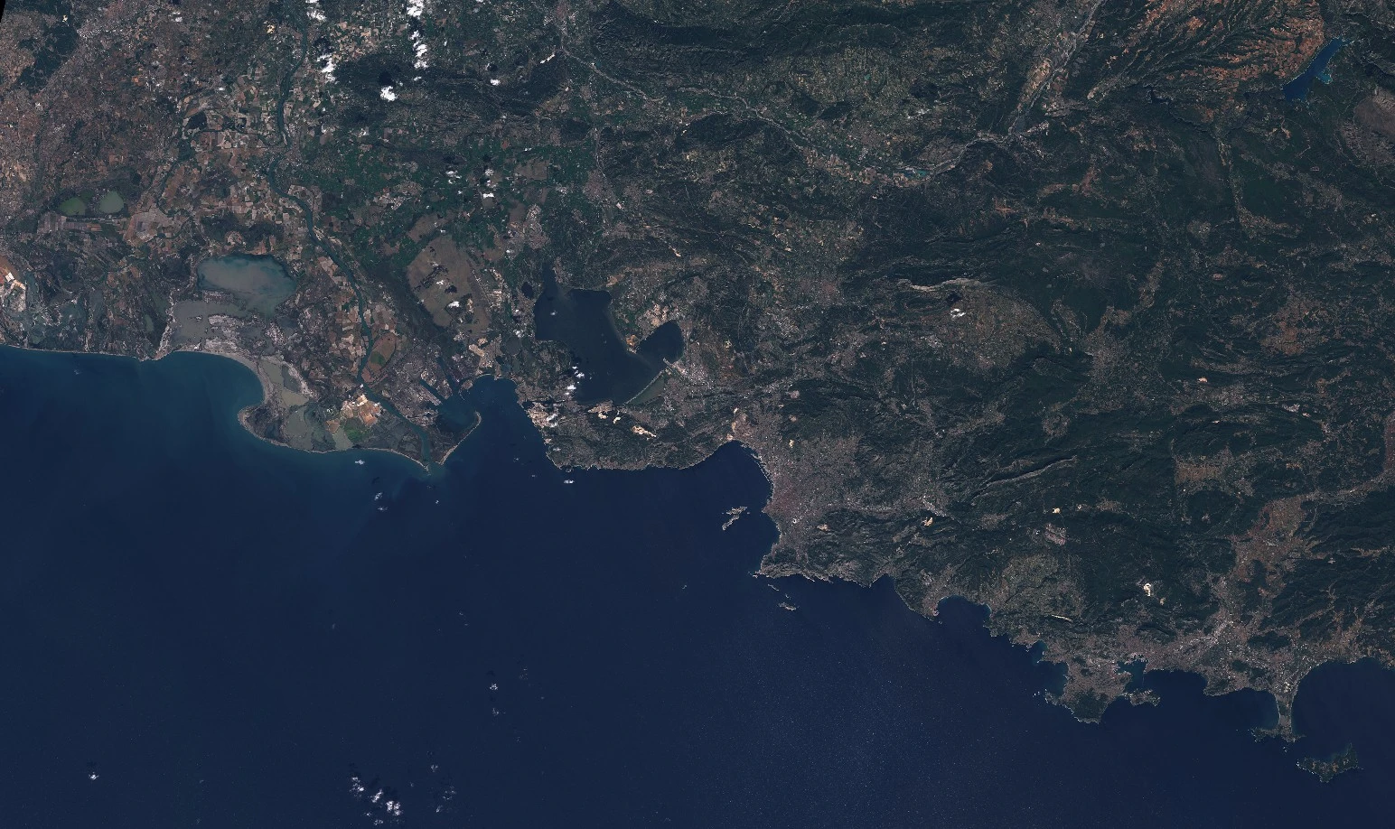
Marseille l1c
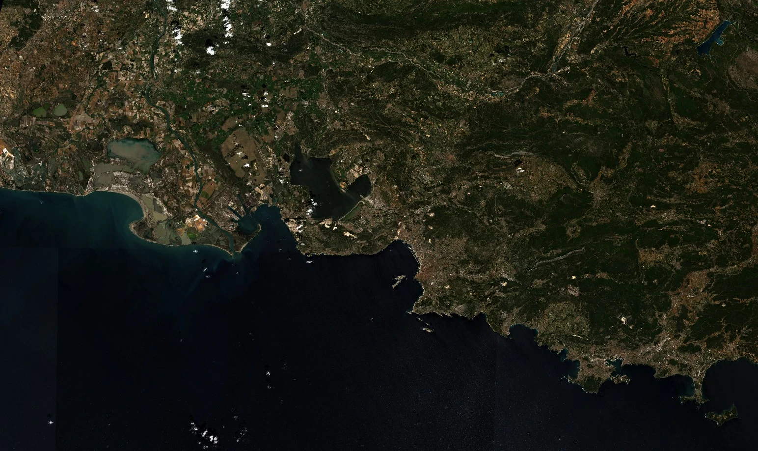
Marseille l2a