Tanager Linestring Tasking
What is a Linestring?
A linestring order tasks Tanager along a line with a start point and end point defined by the user rather than over a polygon or point. The satellite collects a continuous strip centered on that line, approximately 18 km wide (at nadir), oriented to follow the line. Linestrings are available globally and are supported for flex and assured tasking. A key feature of assured linestring tasking is the ability to ensure the task will be scheduled and collected, as the user must choose a specified time window where this is possible.
Why task a linestring?
- Freedom of orientation: A linestring can be tasked at any orientation, so elongated features — pipelines, valleys, coastlines, basin axes, transport corridors — can be followed directly rather than split among many scenes.
- Consistent coverage in a single overpass: A polygon split into multiple strips is collected across different days, while a linestring is designated to collect the entire task in one pass so the result has more consistent measurement conditions.
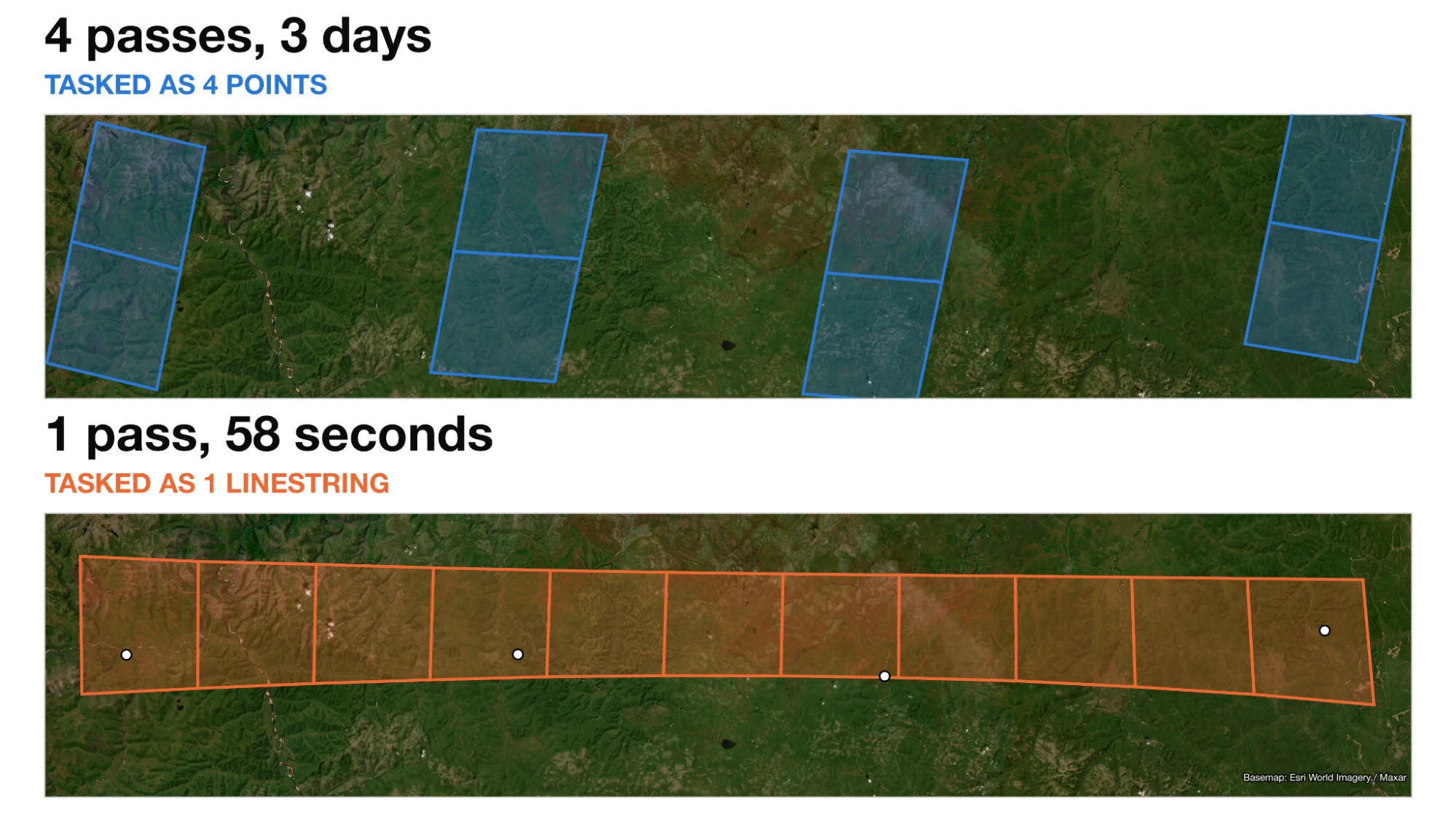
Comparison of tasking via points vs. linestrings in eastern Siberia: four point tasks need 4 passes over 3 days, while a single linestring covers the same features in 1 pass of 58 seconds.
- Fewer tasks per area of interest: Automated polygon tessellation uses the orbital path to cover an area, at times requiring more tasks than needed to fulfill the order. A linestring drawn along the axis of your area of interest can cover the same ground in fewer collects, fulfilling an order faster.
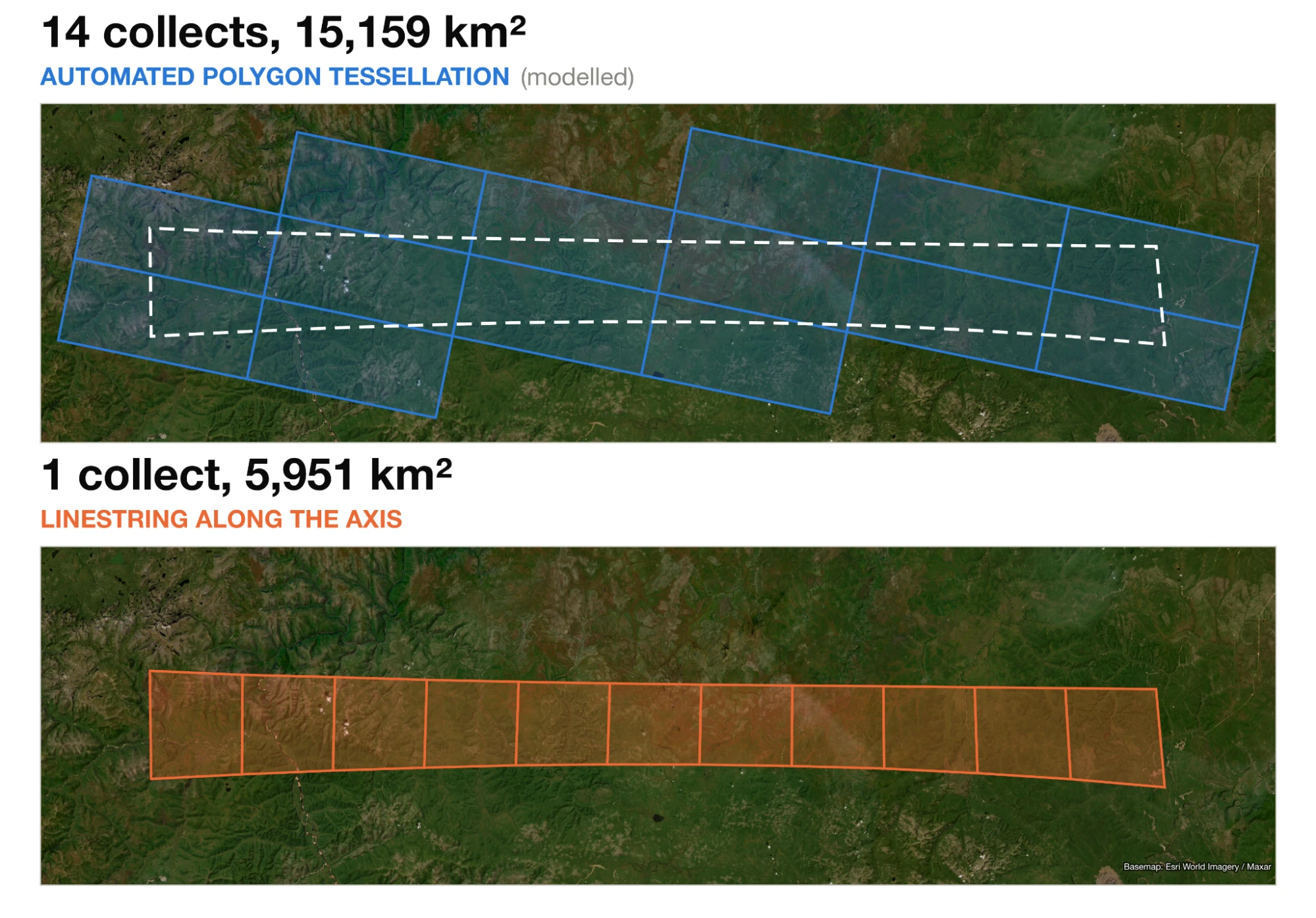
Comparison of tasking via tessellated area vs. linestrings in eastern Siberia: automated polygon tessellation needs 14 collects covering 15,159 km², while a linestring along the axis needs 1 collect covering 5,951 km².
Please note that with a longer east-west oriented linestring, the feasibility for scheduling this type of order is lower.
Choosing a sensitivity mode
Tanager increases sensitivity through back-nodding — a maneuver that allows the instrument to dwell longer on each area and improves the signal-to-noise ratio (SNR). Because the satellite spends more time over less ground, maximum line length decreases as sensitivity increases:
Maximum sensitivity is best suited to point collects and short strips; its required maneuvers reduce the feasible opportunities for a long line. Where coverage matters more than peak signal-to-noise, Standard or Medium sensitivity covers substantially more ground per task and is schedulable on more orbits, thus making those modes more optimal for linestring tasking.
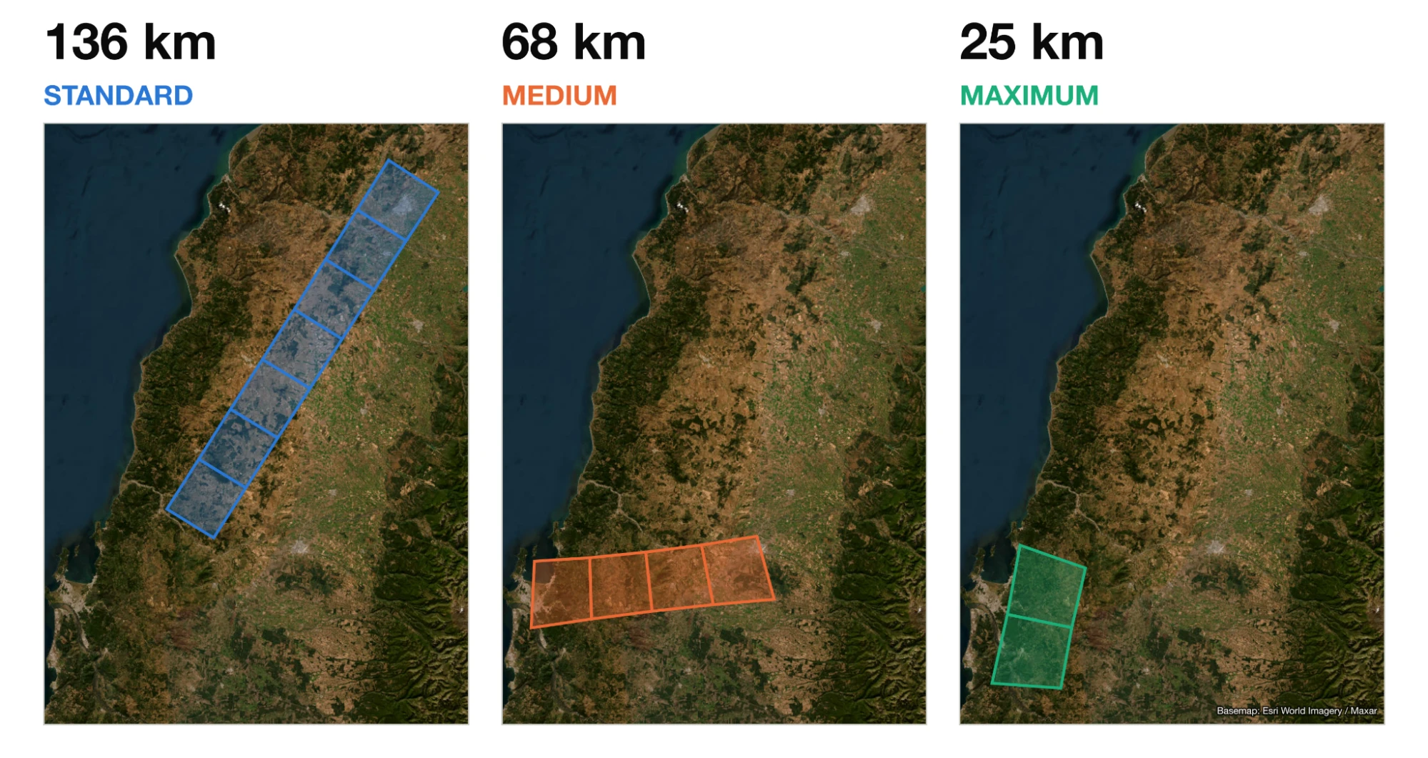
Example of varying linestring lengths per sensitivity mode: 136 km at Standard, 68 km at Medium, and 25 km at Maximum.
Maximum line length by sensitivity mode
| Sensitivity mode | Integration time | Max line length |
|---|---|---|
| Standard (1x8 ms) | 8 ms | 443 km |
| Medium (2x8 ms) | 16 ms | 146 km |
| High (3x8 ms) | 24 ms | 87 km |
| Maximum (4x8 ms) | 32 ms | 62 km |
| Glint (1x8 ms) | 8 ms | 443 km |
Values apply to Tanager-1 at 430 km altitude; maximum area assumes an approximately 18 km swath width. Slight deviations can occur due to waypoint buffers, imaging with a cross-track angle, and altitude variation. These maximum lengths are under ideal conditions (for example, along orbital track).
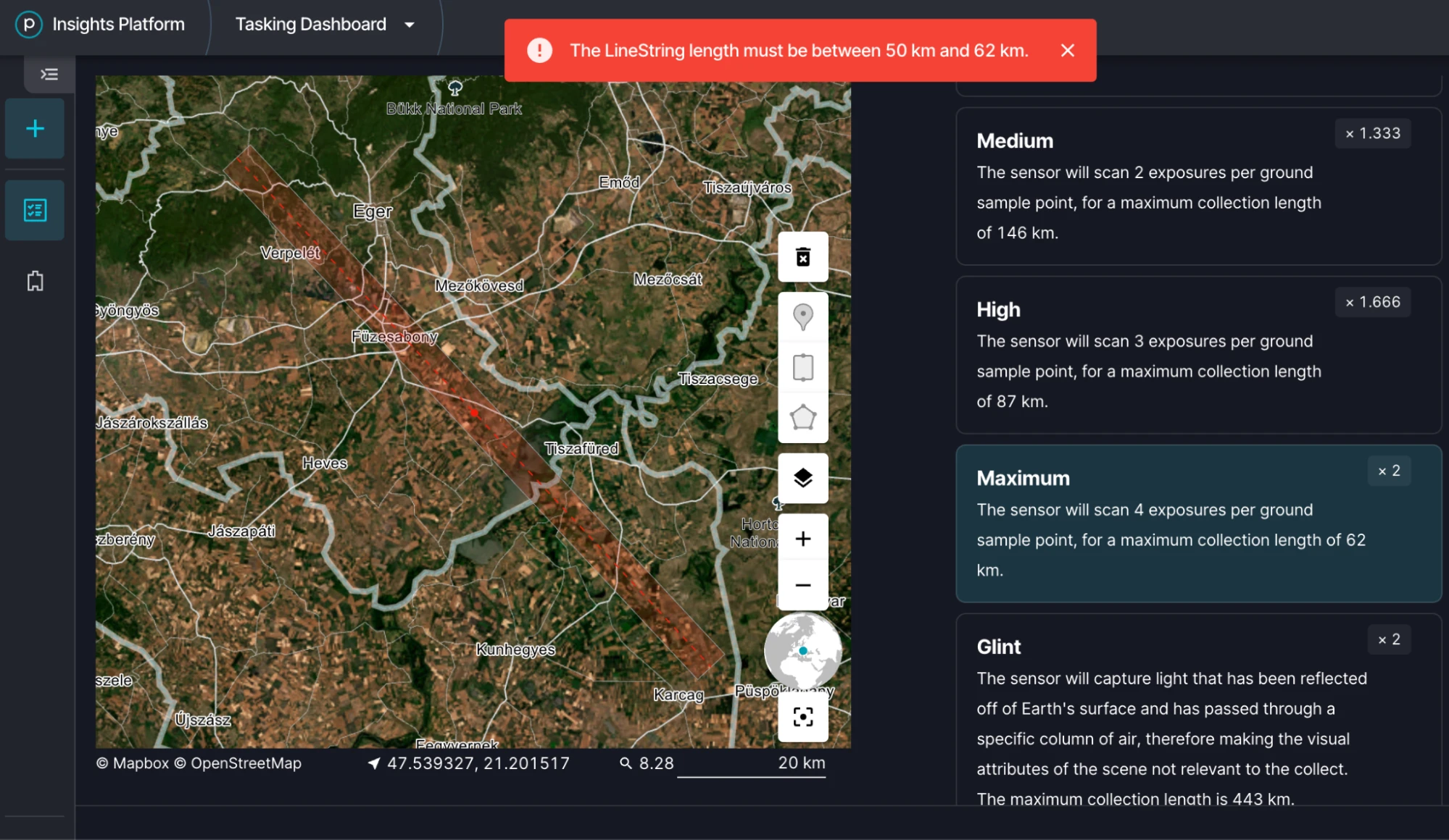
Warning in the Tasking Dashboard when a linestring is outside the allowed length for the selected sensitivity mode, here “The LineString length must be between 50 km and 62 km” for Maximum sensitivity.
Additional tasking considerations
- Clouds. A linestring covers a larger area than a point collect (100 sqkm), so the likelihood of clouds somewhere in the footprint is correspondingly higher.
- Orbital geometry. Feasibility improves where the line aligns with Tanager's ground track, which minimizes cross-track slew and maximizes integration time per overpass. Lines drawn across the ground track are less likely to be feasible, and thus could result in tasks that are rarely or never scheduled.
- Off-Nadir Angles and delivery. Tanager images at up to ±30° off-nadir along-track and/or cross-track. Tasking nearer nadir preserves both strip length and the number of feasible opportunities.
Example workflow in the Tasking Dashboard
Step 1:
- Provide the name, select your contract number, and your product of interest. In this example, the Flexible Core Imagery for Methane was chosen.
Step 2:
- Select “Line” as your area of interest.
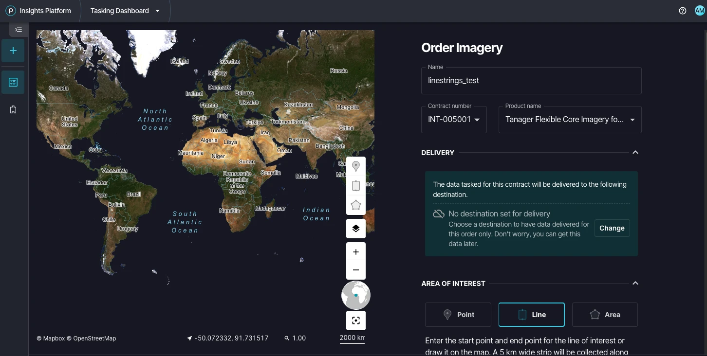
The Order Imagery form in the Tasking Dashboard with Line selected as the area of interest type.
Step 3:
- Select your time of interest, and the products you would like to receive.
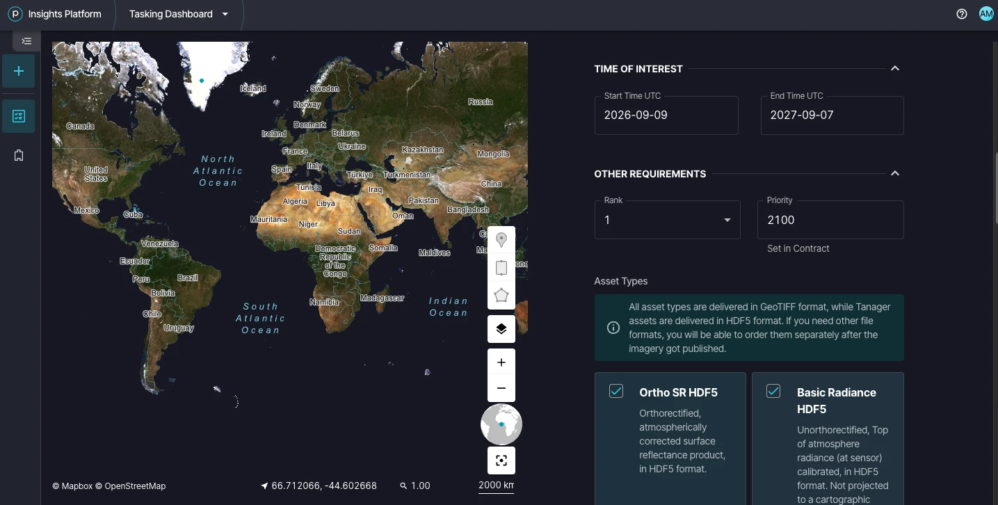
The Time of Interest section with start and end dates, and the Asset Types section with Ortho SR HDF5 and Basic Radiance HDF5 selected.
Step 4:
- Zoom into your area of interest, select your sensitivity mode, and click on the map at the start and end point to draw your line. If you see a warning flag, the linestring might be too long. If so, click on delete and try again. Modify your constraints if necessary (for example, cloud coverage, Off Nadir Angles, etc.).
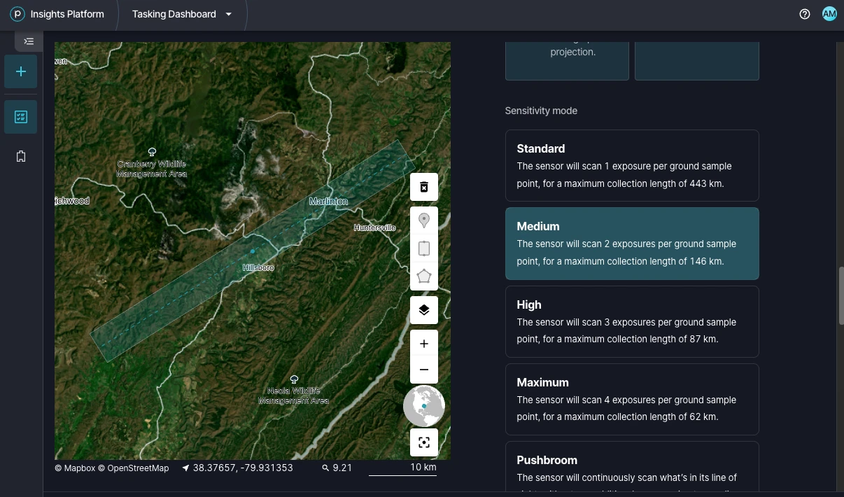
A linestring drawn on the map with Medium sensitivity mode selected, showing the collection strip along the line.
Step 5:
- Review parameters and submit your task.
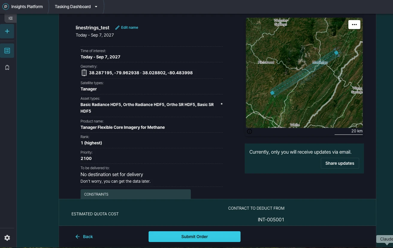
The order review page summarizing the linestring geometry, asset types, product, and priority, with a map preview and the Submit Order button.