RapidEye
RapidEye, formerly operated by Planet, is a retired constellation of five satellites operating from 2009 to 2020. RapidEye images are approximately 5 meters per pixel resolution and are still available for download through Planet platforms.
The RapidEye satellite constellation consisted of a single launch of five high-resolution satellites.
RapidEye Imagery Products
RapidEye products, such as Scene and Orthotile, are available for search and download via the Planet APIs, User Interfaces, and Integrations. The platform encodes these products as a set of Item Types and Asset Types.
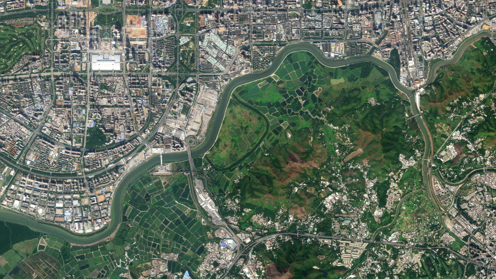
A RapidEye Scene Product is a framed scene captured by the satellite in its line scan of the Earth. Scenes within a strip overlap and are not organized according to any particular tiling grid system. RapidEye Scene Products range from 75 x 50 square kilometers to 75 x 300 square kilometers. They are represented in the Planet Platform as the REScene item type.
A RapidEye OrthoTile Product is a 25 x 25 square kilometers orthorectified and tiled product generated from consecutive scenes within a strip (usually 1 or 2), based on a worldwide, fixed UTM grid system. They are represented in the Planet Platform as the REOrthoTile item type.
Asset Types
Basic Analytic
Basic Analytic (basic_analytic) assets are non-orthorectified, calibrated, multispectral imagery products corrected for sensor artifacts and transformed to Top of Atmosphere (at-sensor) radiance. These products are designed for data science and analytic applications and for users who wish to geometrically correct the data (leveraging the associated rational polynomial coefficient Asset Type).
Analytic
Analytic (analytic) assets are orthorectified, calibrated, multispectral imagery products that have been corrected for sensor artifacts and terrain distortions, and transformed to Top of Atmosphere (at-sensor) radiance. These products are designed for data science and analytic applications that require imagery with accurate geolocation and cartographic projection.
Visual
Visual (visual) assets are orthorectified and color-corrected to optimize colors seen by the human eye, providing images as they would look if viewed from the satellite's perspective. These products are designed for simple and direct visual inspection, and can be used and ingested directly into a Geographic Information System or application.
Surface Reflectance
Surface Reflectance (analytic_sr) assets are orthorectified and radiometrically corrected to ensure consistency across localized atmospheric conditions and to minimize uncertainty in spectral response across time and location. These products are designed for temporal analysis and monitoring applications, especially in agriculture and forestry sectors.
Product Naming
The name of each acquired RapidEye image is designed to be unique and allow for easier recognition and sorting of the imagery. It includes the date and time of capture, the satellite's ID, product level, and product type. The name of each downloaded image product is composed of the following elements:
RapidEye scene downloaded product name
The name consists of the following elements:
{acquisition-date}T{acquisition-time}_{satellite-id}_{product-level}_{band-product}.{extension}
Example:
- 2018-09-29T163919_RE1_1B_band1.tif
RapidEye orthoTile downloaded product name
The name consists of:
{tileid}_{acquisition-date}_{satellite-id}_{product-level}_{band-product}.{extension}
Example:
- 1657017_2018-09-29_RE1_3A_Analytic.tif
Processing Steps
Several processing steps are applied to RapidEye imagery to produce the data products that are available for download.
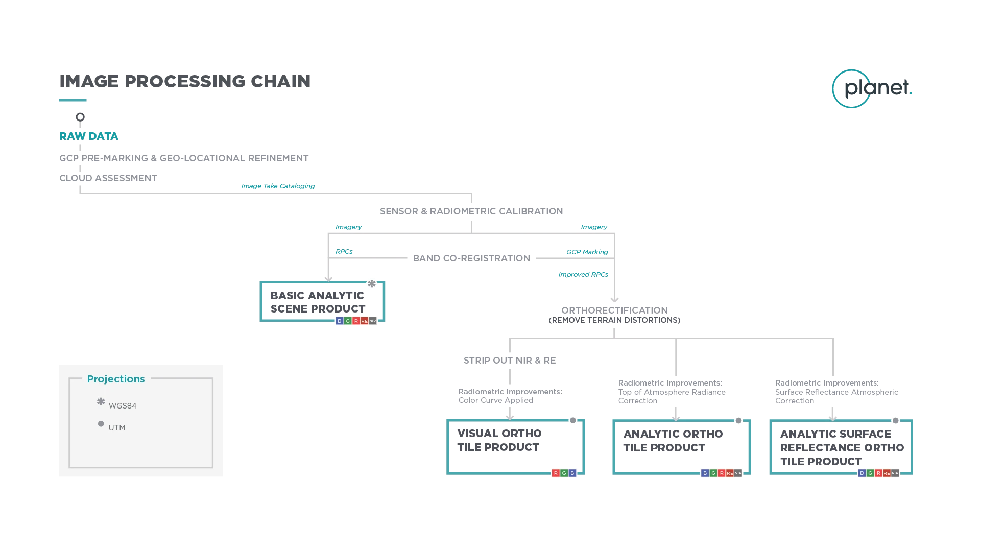
Sensor and Radiometric Calibration
Flat Field Correction: Flat fields were collected for each optical instrument before launch. These fields were used to correct image lighting and CCD element effects to match the sensor's optimal response area.
Temporal Calibration: To achieve cross-calibration, corrections were applied such that all RapidEye cameras read the same DN (digital number) regardless of when the image was taken during the mission lifetime.
Absolute Calibration: As a last step, the spatially and temporally adjusted datasets were transformed from digital number values into physical based radiance values (scaled to W/(m²strμm)*100).
Orthorectification
Removes terrain distortions. This process consists of two steps:
- The rectification tiedown process wherein tie points are identified across the source images and a collection of reference images (ALOS, NAIP, Landsat) and RPCs are generated.
- The actual orthorectification of the scenes using the RPCs, to remove terrain distortions. The terrain model used for the orthorectification process is derived from multiple sources (Intermap, NED, SRTM and other local elevation datasets), which are periodically updated. Snapshots of the elevation datasets used are archived (helps identify the DEM used for any given scene at any given point).
Visual Product Processing
Presents the imagery as natural color, optimized as seen by the human eye. This process consists of three steps:
- Nominalization - Sun angle correction to account for differences in latitude and time of acquisition. This makes the imagery look like it was acquired at the same sun angle by converting the exposure time to the nominal time (noon).
- Unsharp mask (sharpening filter) applied before the warp process.
- Custom color curve applied post-warping.
Surface Reflectance Product Processing
Removes atmospheric effects. This process consists of the following steps:
- Top of Atmosphere (TOA) reflectance calculation using coefficients supplied with the at-sensor radiance product.
- Lookup table (LUT) generation using the 6SV2.1 radiative transfer code and MODIS near-real-time data inputs.
- Conversion of TOA reflectance to surface reflectance for all combinations of selected ranges of physical conditions and for each satellite sensor type using its spectral response and estimates of the state of the atmosphere.
For detailed technical information on RapidEye images, refer to Planet Imagery Product Specification.